Enhance your existing data and platforms by way of integration, not replacement, to bring your geospatial, as-built visual twin to life.
By integrating best in class platforms and applications with your visual twin, we can contextualise your data to create your ultimate digital twin ecosystem.
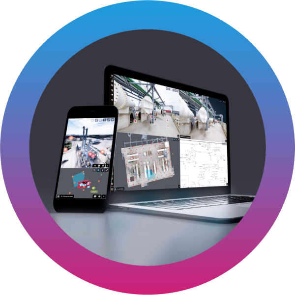
Contextualise siloed data, streamline data flow and simplify sharing
Unlock your organisation’s siloed data sources and systems with ZynQ’s powerful and flexible API framework.
The ZynQ asset visualisation platform allows organisations to effortlessly integrate business-critical systems such as ERP, CMMS, Asset Registers, and more, automatically linking them to a geo-spatial location within ZynQ. Configure controls to determine the data to be pushed or pulled and manage update frequencies, whether daily, hourly, or real-time.
We recognise that integration is not a one-size-fits-all solution; every business has unique systems, data structures, and schemas. That’s why we take an agile approach, collaborating closely with our clients to deliver tailored visual asset management solutions that meet their specific needs.
With our geo-spatial API, third-party applications can embed location views, accurately aligning views across platforms and synchronising user navigation and movement.
Not quite ready for API integration? No problem. We support importing and managing documents and registers, with the ability to easily geo-spatially tag them within ZynQ.